

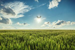
Drones and Satellites: match made in the sky
By Jennifer Jackson
Some producers may have a strict preference for either drone or satellite imagery for use on the farm. However, it may not be a choice that needs to be made, some industry experts say. The two technologies vary in their uses and could complement each other well under the right conditions.
Mary Ruth McDonald, a professor in the University of Guelph’s plant agriculture department, has used drones for the past three years, studying their effectiveness for disease and pest management in vegetable crops.
McDonald realized many of the factors her team would be researching, such as the colour of the canopy in the field, was subjective. She hoped that drones would enable the team to gather more objective assessments of the crops.
McDonald and her team used the drones in two ways: “one way was taking colour photographs – we could see patterns of disease develop. The difference in (canopy) colour related to the damage of the leaves,” she says. “We also used a near infrared camera in hopes that it would show us plant stress, something that the regular camera might not pick up.”
McDonald explained they have not yet seen significant differences between the techniques. She attributes this lack of difference, however, to the evolving technology in the cameras.
Throughout the research, McDonald and her team experienced both the benefits and limitations of drone usage.
“We worked with a company that had a licence for the drones – they were experienced flyers,” says McDonald. This was important as “some of my colleagues took a while to learn to fly the drones without crashing.
“We could (also) see the differences of maturity throughout the growing season,” she said. “The images we were taking of our plots also (could) have been great for herbicide experts, as it was quite easy to distinguish between the crops and weeds.”
McDonald and her team did face some limitations of the drone technology with their project.
“The pictures we had took up a lot of computer space,” she said. “For pests, we had hoped to fly the drones on Monday and then check out the crops on Thursday or Friday – you get a lot of pictures and it does take time to go through them. We got useful information but not as quickly as I thought.”
McDonald says she will continue to work with drone technology in hopes to improve its usage for identifying pest damage in vegetable crops. “There is still a lot of work that can be done in terms of managing and spotting plant stress – we certainly learned a lot.”
Some of the drone’s limitations could be addressed with satellite imagery – the same way drones could help to overcome some of the restrictions of satellites, says Nathan Wainscott, an agriculture technology specialist at WinField United.
“We use the philosophy that neither (drones nor satellites) work as well (as they could) unless they are used together,” he says.
Drone imagery can be tedious to stitch together, Wainscott says. When you have a satellite image, however, you can determine an exact area you would like to monitor and send the drone to that spot. This technique would reduce the compilation of high-resolution drone images, as they could be created for a targeted area as opposed to for the whole field.
“Drones have the benefit of being able to go out and get an image when you need it,” he says. Although the satellite technology is developing, “you are at the mercy of Mother Nature, (as) it may be cloudy when the satellite flies over.”
Satellites and drones “both have their fit, yet they both work well together – they both have their advantages and downfalls,” says Wainscott.BF

Photo credit: valio84sl/iStock/Getty Images Plus photo
Satellite imagery: Multi-use, multi-purpose
Finding a fit for imagery on-farm
by Jennifer Jackson
Trevor Scherman has found a fit for satellite imagery on his cash crop farm in Saskatchewan.
“I like to call (satellite imagery) the starting point,” he says. “Then, you put your boots on the ground.”
Scherman has used the tool for the past six growing seasons. In that time frame, he has found multiple uses, including monitoring a number of chemical, varietal and fertilizer trials.
Specifically, Scherman uses the imagery to help build soil zones that he can then use together with normalized difference vegetation index (NDVI) images of his crops in-season to monitor yield-costing issues, such as poor drainage or plant disease.
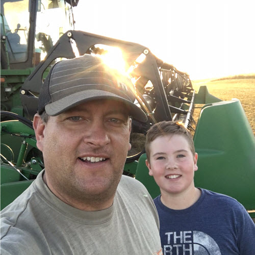
Photo: Trevor Scherman and his son, Levi.
“(Satellite imagery) gives you a good idea of where to go scout – or even if you know you’ve tried something (new management-wise), it gives you the opportunity to go and monitor (those management changes),” he says. “We’ve monitored different planting dates, different hybrids, (varying) maturities, fungicide use – (satellite imagery is) just another tool.”
As for the usability of the imagery?
“It’s very simple – I can go through crop health maps field by field, either by phone or on the Farmers Edge website,” he says. “Running a high fertility program, you don’t want to miss anything.”
Scherman has also found that satellite imagery can help in the expansion of his operation.
“There’s a history with the images – I can go back to 2004,” he says. The imagery helps in “assessing land that I may want to purchase – benchmarking it to (the past performance) of my land.”
Essentially, the varying uses and ease of obtaining satellite imagery motivate Scherman to continue using the technology for years to come.
From variety trials to assessing where to implement strategies like tile drainage, satellite imagery has proven to be useful on Scherman’s farm. BF
Photo cutline: Trevor Scherman and his son, Levi.
Post new comment